Södermalm walking tour guide: Stockholm's creative neighbourhood
Stockholm: bohemian Södermalm island walking tour
Duration: 1.5 hours
Is Södermalm worth walking for tourists?
Absolutely. Södermalm offers the best elevated views over Gamla Stan and Stockholm's waterways, a genuine neighbourhood atmosphere away from the tourist track, excellent cafés and independent shops, and Fotografiska — one of Scandinavia's best photography museums. Allow 2–3 hours for a good walk.
The island that Stockholmers actually live in
Södermalm — “Söder” to locals — is the large island immediately south of Gamla Stan, connected by the Slussen interchange. It is Stockholm’s most populated and culturally diverse neighbourhood, home to an eclectic mix of creative industries, independent restaurants and cafés, vintage shops, and some of the city’s best-known viewpoints.
Unlike Gamla Stan, which is a tourist area with Stockholmers threading through it, Södermalm is a neighbourhood where tourists are visitors to something real and ongoing. That distinction matters: the atmosphere is more relaxed, the prices are generally lower, and the streets away from the main routes feel genuinely lived-in rather than performed.
The island is hilly — the cliffs (Söderberg) that run along its northern edge rise sharply above the water, and several of the viewpoints require a climb — but none of it is strenuous. The rewards are some of the best photographs in Stockholm.
This route focuses on walking and viewpoints; for a deeper look at the neighbourhood’s history and zones, see the Södermalm neighbourhood deep dive, and for a food-first version of the same ground, the Södermalm food scene guide.
Practical essentials
| Detail | Information |
|---|---|
| Walk duration | 2–3.5 hours (full circuit) |
| T-bana | Slussen, Medborgarplatsen, Mariatorget, Hornstull (all on red/green lines) |
| Terrain | Hilly; some steep paths and stairs |
| Best time | Any — morning for views, afternoon for café culture |
| Starting point | Slussen (exits to both Gamla Stan and Södermalm) |
The recommended walking route
Starting point: Slussen and Katarinavägen
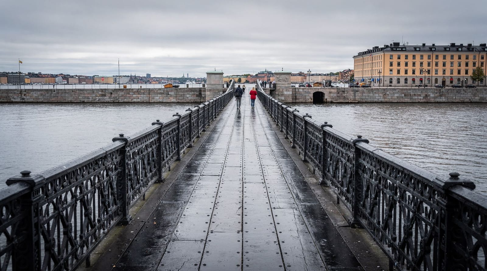
Begin at Slussen, the interchange between Gamla Stan and Södermalm. The area has been under reconstruction for years (a major urban renewal project completing in stages through 2025–2026) but the pedestrian routes are clearly signed. Take the lift or staircase up from Slussen to Katarinavägen, which runs along the cliff edge above.
From Katarinavägen, the viewpoint south of Stadsmuseet offers the first good overview of Gamla Stan and Riddarfjärden. This is not yet Monteliusvägen — just an appetiser.
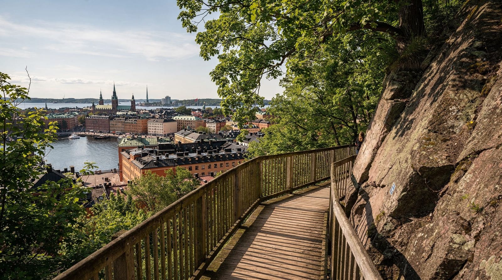
Södermalm’s cliff-edge: Monteliusvägen
The highlight of any Södermalm walk. Monteliusvägen is a wooden promenade running along the cliff edge (Mariaberget) above Riddarfjärden, giving an elevated view west across the water to the City Hall (Stadshuset) and north to Gamla Stan and Kungsholmen.
The promenade is approximately 500 metres long, running from near Bastugatan in the east to Bellmansgatan in the west. Along the way there are several classic viewpoint spots where photographers set up at golden hour. The view at dusk in summer, when the City Hall’s tower reflects in the water, is one of Stockholm’s genuinely beautiful scenes.
Access is via Bastugatan (from Slussen) or from Maria Magdalena kyrka. The climb is approximately 30 metres of elevation, achievable on foot via stairs or a gently sloping path.
Mariatorget
From Monteliusvägen, descend south to Mariatorget, the main square of Södermalm’s western half. It is a wide, tree-lined square with benches, a central fountain, and the kind of neighbourhood café culture that Stockholm does well. This is a good fika stop — Café Saturnus (on Eriksbergsgatan) is one of Stockholm’s legendary bakery cafés, known for enormous cinnamon rolls.
Mariatorget has a farmers’ market on most Saturdays (seasonal). The surrounding streets — Hornsgatan, Bergsundsgatan — have an interesting mix of vintage shops, galleries, and independent restaurants.
The SoFo neighbourhood
East of Medborgarplatsen, the area known as SoFo (South of Folkungagatan) is Södermalm’s most fashionable quarter. The name is a self-conscious nod to New York’s SoHo, and the neighbourhood lives up to the comparison: independent fashion boutiques, design shops, wine bars, and the kind of restaurant where the menu changes weekly and reservations are needed.
The streets around Nytorgsgatan and Skånegatan are the core. Nytorget square itself has a water tower (now an events space) and outdoor seating that fills up on warm evenings. This area is worth a slow meander — the concentration of good independent shops and restaurants per street is higher than almost anywhere else in Stockholm.
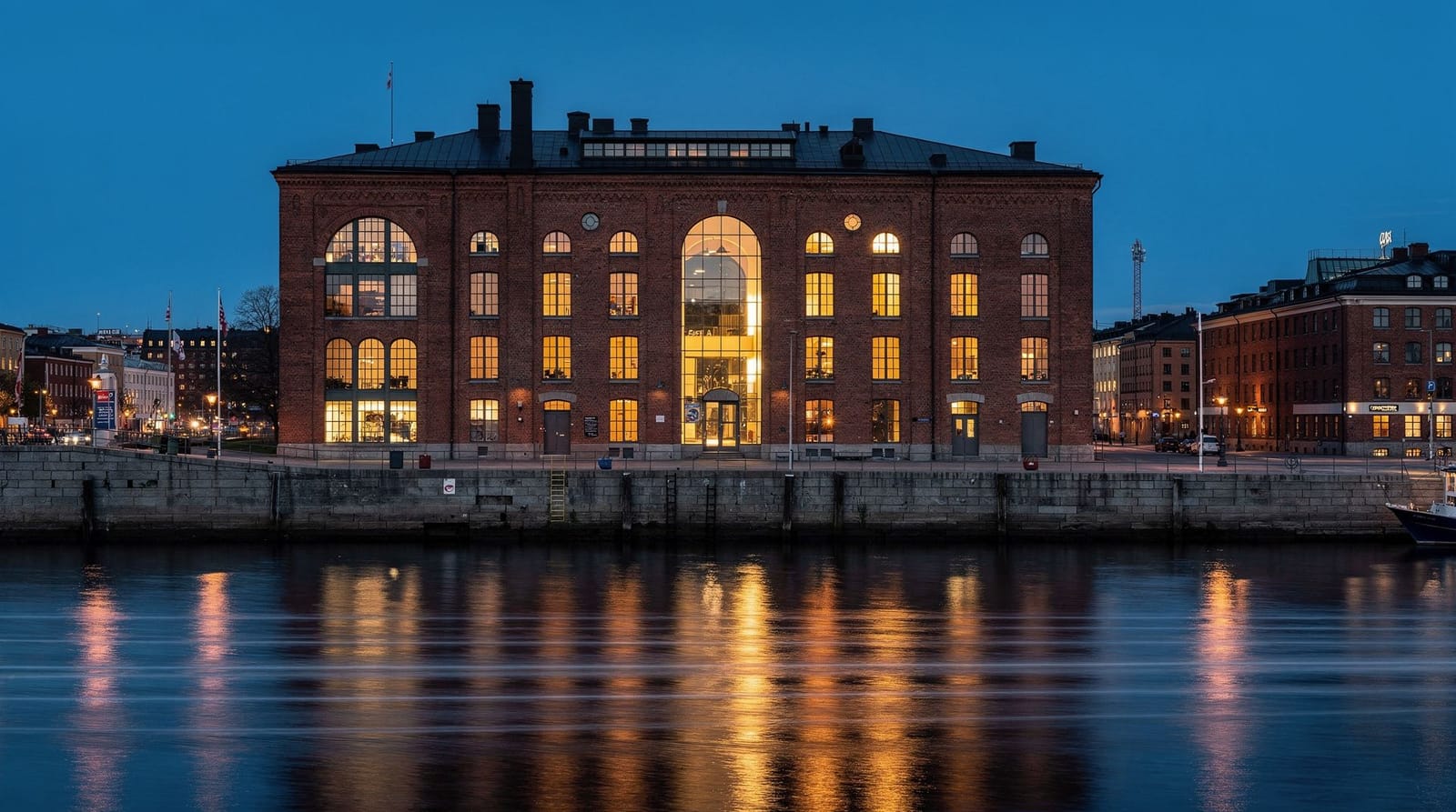
Fotografiska
At the eastern end of Södermalm, Fotografiska is housed in a converted customs warehouse on the waterfront. It is one of Scandinavia’s leading photography museums, with an exhibition programme that rotates regularly and consistently features world-class photography.
Entry costs approximately 175 SEK. The museum is also notable for its restaurant and café, which serve some of the best food of any Stockholm museum. See the Fotografiska guide for full details.
Hornstull and the western end
Hornstull, at the western tip of Södermalm, is the neighbourhood’s most relaxed corner. The Hornstull market (seasonal, weekends) is Stockholm’s largest outdoor vintage and secondhand market — genuinely useful for both shopping and people-watching. Liljeholmskajen across the bridge has additional stalls in summer.
The waterfront promenade running east from Hornstull bridge towards Eriksdalshamnen passes several outdoor bathing spots popular with locals in summer.
Best viewpoints on Södermalm
Monteliusvägen — the gold standard. City Hall and Gamla Stan from above, best at golden hour.
Fjällgatan — a cliff-edge street on the east side of the island, above Fotografiska, giving a different angle looking out over the Baltic inlet and the islands to the east. Less visited than Monteliusvägen and arguably as good for photography.
Skinnarviksberget — a rocky hill in the western part of the island, with 360-degree views. Requires a short climb. Popular with locals on summer evenings for spontaneous outdoor gatherings (bring a bottle of something cold).
| Viewpoint | Crowds | Best for |
|---|---|---|
| Monteliusvägen | Busiest | Classic City Hall / Gamla Stan shot |
| Fjällgatan | Moderate | Wide Baltic panorama, quieter |
| Skinnarviksberget | Lowest | 360-degree, local evening atmosphere |
What to eat and drink
Södermalm has Stockholm’s best casual restaurant-to-tourist ratio — meaning quality is higher and prices slightly lower than in Gamla Stan or Norrmalm.
Café Saturnus (Eriksbergsgatan 6) — the cinnamon roll is enormous and excellent.
Hermans Trädgårdscafé (Fjällgatan 23b) — a legendary vegetarian restaurant with a terrace overlooking the water. The lunch buffet has been running since 1978.
Pelikan (Blekingegatan 40) — Stockholm’s most respected traditional Swedish inn (krog), open since 1904. Order meatballs with lingonberry, herring, or smörgåsbord.
Chutney (Katarina Bangata 19) — excellent Indian-influenced vegetarian, busy at lunch.
Bar Agrikultur (Repslagargatan 8) — natural wine bar with food; go in the evening.
Shopping on Södermalm
Södermalm is the best area in Stockholm for independent shopping. Key areas:
Hornstull market (weekends, May–September): Vintage clothing, furniture, records, food.
SoFo area (Skånegatan, Nytorgsgatan): Independent fashion, design objects, bookshops.
Götgatan: The main commercial street, with a mix of Swedish brands (Acne Studios, Filippa K, Sandqvist) and international chains.
Guided tour options
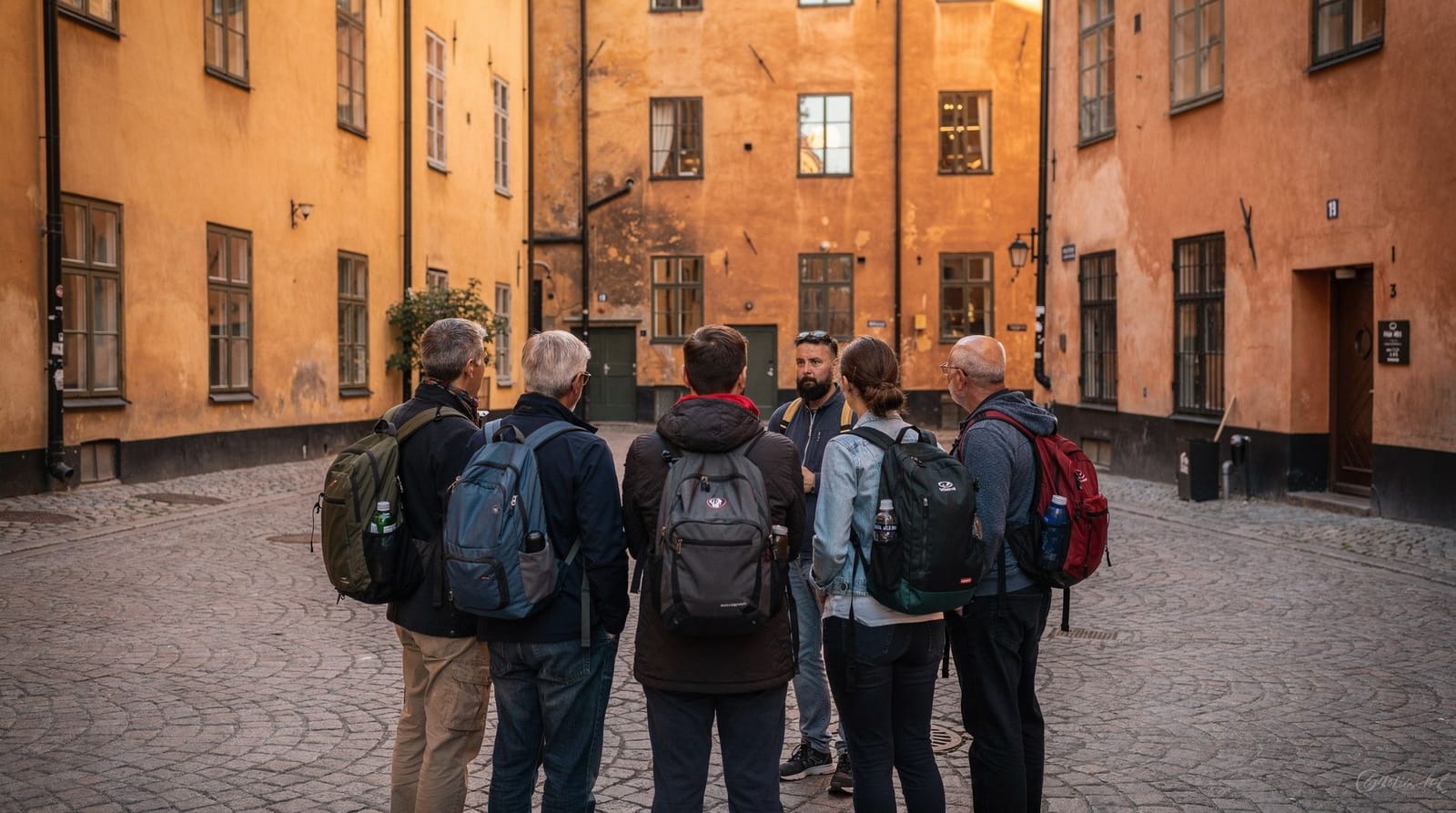
Urban art and hidden gems: guided Södermalm tourA guided tour of Södermalm is worth considering if you have only a few hours — a good guide will take you off the main streets into the courtyards, up to the viewpoints by the quickest routes, and will explain the neighbourhood’s social history (Söder was a working-class area until the 1990s, which explains much of its character). The urban art tour format is particularly good for younger visitors or those interested in contemporary design.
Södermalm’s social history
Understanding Södermalm’s social history explains why the neighbourhood feels the way it does. Until the 1980s, Södermalm was a working-class district — the island where industrial workers, manual labourers, and lower-income families lived. The same cliff that now provides Instagram-perfect viewpoints once defined a geographical separation between the wealthy north (Östermalm, Norrmalm) and the working south.
The transformation began with the artists and bohemians who were drawn to the cheap rents and anti-establishment atmosphere in the 1970s–80s, followed by the wave of gentrification in the 1990s–2000s that pushed out some of the original working-class residents while preserving much of the built environment. The result is a neighbourhood that retains the physical fabric of its working-class past — dense apartment blocks, narrow streets, public bathing places, community gardens — while now housing a mix of creative professionals, young families, and the last generation of original residents.
This history is visible in the architecture if you know what to look for. The large apartment blocks on Götgatan from the 1950s–60s (built as social housing) stand alongside 19th-century workers’ tenements on the side streets. The presence of cooperative housing (bostadsrättsföreningar) throughout the island reflects the tradition of collective ownership that Stockholm’s working class pioneered.
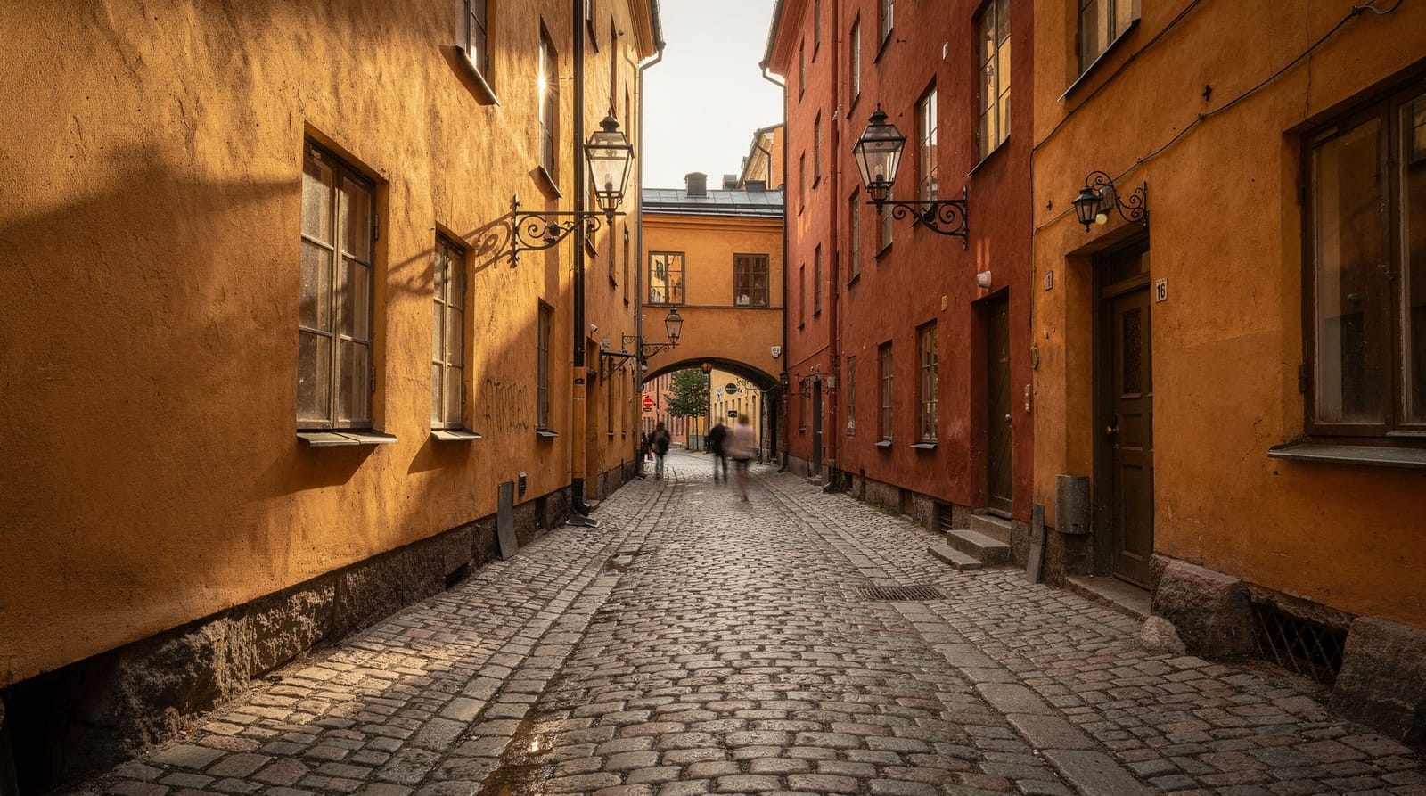
Mariaberget and the cliff quarter
The cliff section of Södermalm (Mariaberget) between Slussen and Hornstull is one of Stockholm’s most architecturally interesting residential areas. The streets cut into the cliff at different levels — Bastugatan, Bellmansgatan, Bergsundsgatan — creating a layered landscape where adjacent buildings can be three or four floors apart in elevation.
The name Mariaberget comes from Maria Magdalena church (kyrka), which sits on the cliff above Hornsgatan. The church dates from the 17th century in its current stone form; there has been a church on this site since the 14th century. The exterior is relatively plain; the interior is worth entering for the 17th-century burial vault section.
The streets of Mariaberget are best explored slowly, following the levels rather than fighting them. From any street, a short staircase or path descends or ascends to a different level with a different street character. It is one of the few places in Stockholm where the topography creates genuine architectural surprise.
Bellmansgatan in particular is worth a slow pass — the street is named after the 18th-century poet Carl Michael Bellman, who wrote extensively about Stockholm’s working life and pleasure gardens, and several buildings along it date from that era, giving a tangible sense of the pre-industrial city beneath the later apartment blocks.
Night-time Södermalm
The neighbourhood transforms after 20:00. The working-day cafés and restaurants shift register; new venues open; the streets fill with a different crowd. Södermalm’s nightlife is centred on two distinct zones:
Medborgarplatsen area: The large square and its surrounding streets (Folkungagatan, Skånegatan) concentrate the majority of Södermalm’s bars and restaurants. Thursday and Friday evenings are the most animated; Saturday evenings reach their peak around 22:00.
Hornstull waterfront: A more relaxed summer evening scene along the waterfront, with outdoor bars and the Hornstull Strand open-air setting popular until late.
Södermalm also contains several of Stockholm’s most respected music venues: Debaser (Slussen) and Södra Teatern are the main stages for mid-sized concert acts. For a fuller rundown of the bar landscape beyond these headline names, see the Södermalm bar scene guide.
Seasonal notes for the walk
Summer (June–August): Long daylight hours mean golden hour at Monteliusvägen can fall as late as 21:00–22:00, so there’s no need to rush the day to catch the best light. Outdoor café seating at Mariatorget and Nytorget is in full swing, and Hornstull market runs every weekend. This is the busiest season for the viewpoints, particularly on clear evenings.
Spring and autumn (April–May, September–October): Fewer crowds at the viewpoints, cooler but still walkable weather, and the Hornstull market runs through most of this window too (typically starting in late April/early May and ending in September). Golden hour arrives earlier, making the walk easier to fit into a single afternoon.
Winter (November–March): The viewpoints are still worth visiting — Stockholm’s low winter sun creates a different, often dramatic light across Riddarfjärden — but expect cold, potentially icy cliff paths, and Hornstull market is closed for the season. Dress for the wind on the exposed sections of Monteliusvägen and Fjällgatan.
Combining Södermalm with other areas
Södermalm + Gamla Stan: Easiest combination — cross the Slussplan bridge north. Allow 4–5 hours total. See the Gamla Stan walking tour.
Södermalm + Fotografiska + archipelago: Fotografiska is on the waterfront. From there, several ferry services run east towards the inner archipelago. See the Stockholm archipelago guide.
Södermalm + Djurgården: Take the ferry from Allmänna gränd (seasonal service direct to Djurgården) — one of Stockholm’s most pleasant short crossings. See the Djurgården walking route.
Frequently asked questions about walking Södermalm
How long is the Monteliusvägen walk?
The promenade itself is approximately 500 metres. Including the approach from Slussen and the descent to Mariatorget, allow 45 minutes to an hour for this section alone. Photography enthusiasts will want to linger.
Is Södermalm suitable for families with children?
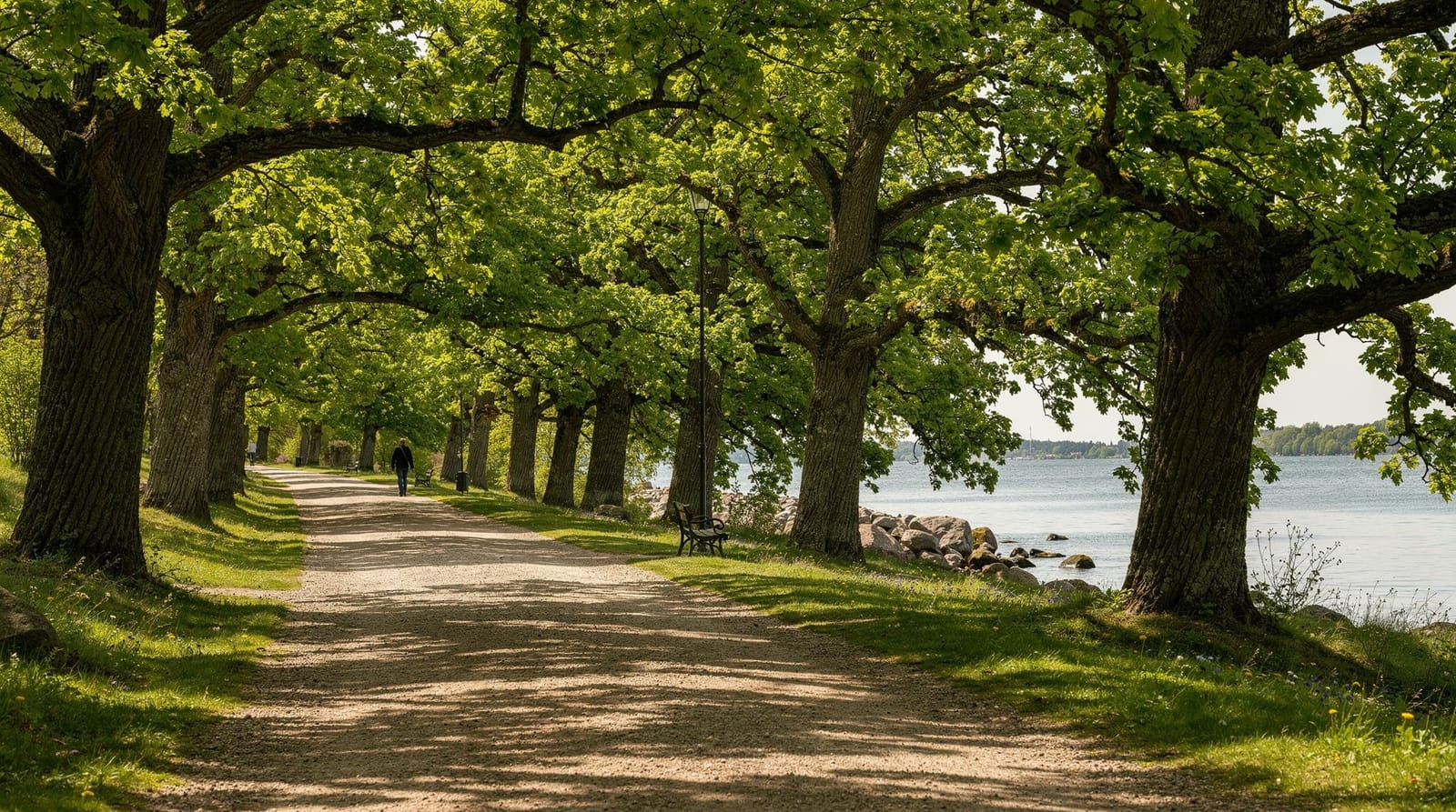
Yes, though the hilly terrain and stairs mean strollers require some planning (lifts are available at Slussen and at several key points on the cliff paths). Tantolunden park in the western part of the island is a popular family destination with picnic areas and a small lido in summer.
What is SoFo and where is it?
SoFo stands for “South of Folkungagatan” — the triangle of streets between Folkungagatan, Götgatan, and Ringvägen. It is the most fashion-forward part of Södermalm, with independent boutiques, wine bars, and restaurants. Best on weekend afternoons.
Is Fotografiska worth the entry fee?
Yes, for most visitors. The exhibition quality is consistently high, the building is beautiful, and the restaurant/café alone is worth a visit. Entry costs approximately 175 SEK; combined tickets with other Stockholm attractions are sometimes available. See the Fotografiska guide.
Can I reach Södermalm without using the T-bana?
Yes easily. Södermalm is directly connected to Gamla Stan by the Slussplan pedestrian bridge (5 minutes from Gamla Stan’s southern end). From Norrmalm/city centre the walk takes about 20 minutes via Gamla Stan. Several bus routes also serve the island directly.
What’s the best order to walk Södermalm’s highlights?
Start at Slussen, climb to Monteliusvägen first while light and energy are fresh, then descend to Mariatorget for a fika break, continue east through SoFo, and finish at Fotografiska or Fjällgatan depending on your remaining time. Doing Fjällgatan or Hornstull first means backtracking across the island later, which wastes time compared to this roughly west-to-east flow.
Do I need a guide to appreciate Södermalm’s viewpoints?
No — the viewpoints themselves need no explanation, just good timing (golden hour) and comfortable shoes. A guide adds value mainly through the social history and hidden courtyards you wouldn’t find alone, which matters more if you’re short on time than if you’re happy to wander.
Top experiences
Bookable activities with verified prices and instant confirmation on GetYourGuide.