Urban running routes in Stockholm: the best loops and paths
Where is the best place to run in Stockholm?
Djurgården is the gold standard — a 7km flat loop through royal parkland past major museums, largely car-free, with good surfaces. For a shorter city-centre run, the Stadshuset (City Hall) waterfront return is 5km on smooth paths. Långholmen island offers a scenic 2km loop with views. All are accessible by T-bana.
Running in Stockholm: an introduction
Stockholm is an underrated running city. The network of parks, waterfront promenades, and car-free paths means you can cover 5–10 kilometres through genuinely attractive terrain without fighting much traffic or navigating convoluted routes. The city’s topography — islands separated by water, connected by bridges — naturally creates loop routes that begin and end at the same point.
Running culture here is strong. The Stockholm Marathon (held in late May or early June) attracts 20,000 participants annually. Local running clubs are active year-round, and you will encounter local runners on all the routes listed here even in December. The city’s ethos of outdoor activity regardless of weather is genuine — Swedes do not stop running because it is raining.
The routes below are ordered from most tourist-accessible to more local in character. Each description includes surface type, difficulty, and the nearest T-bana station for access without a map.
| Where | Djurgården, Långholmen, Trekanten, Kungsholmen, Ekoparken |
| Cost | Free — all routes are public paths |
| Time needed | 20 minutes (Trekanten) to 1.5+ hours (Ekoparken) |
| Getting there | T-bana to the nearest station per route, below |
| Best time | Early morning year-round; May–September for longest daylight |
Running routes compared at a glance
| Route | Distance | Difficulty | Best for |
|---|---|---|---|
| Djurgården loop | 7 km | Easy | First-time visitors, museums en route |
| Långholmen loop | 2 km (repeatable) | Moderate (ridge) | Views, short training laps |
| Trekanten loop | 3.5 km | Very easy | Reliable flat session, any weather |
| Stadshuset waterfront | 5 km return | Easy | Classic City Hall view, point-to-point |
| Ekoparken network | 5–15 km | Variable | Distance runners, forest escape |
Djurgården loop (7km, flat)
The essential Stockholm run. The route circles the royal park island of Djurgården on paths that are predominantly car-free, flat, and well-surfaced. Seven kilometres is the outer circuit; shorter variants are possible by cutting across the island’s interior paths.
Route: Enter Djurgården via the Djurgårdsbroen bridge from Strandvägen. Run east along the northern waterfront past the Vasa Museum, Nordiska Museet, and ABBA The Museum. Continue around the eastern tip of the island (a quieter, more forested section), then loop back west along the southern edge via Rosendal and the canal bank. Return via the main path north to Djurgårdsbroen.
Surface: Mixed tarmac and compacted gravel. Good condition year-round; some gravel sections can be muddy after rain in spring and autumn.
Difficulty: Easy. Flat throughout, no navigation challenges, clear signage.
Best time: Early morning (before 8am) for peace and light; the museums open from 10am and foot traffic increases through the day. Evening runs in June and July benefit from the white-night sky.
Nearest T-bana: There is no T-bana on Djurgården. Access from Slussen (green line) via bus 67, or a 15-minute run from T-Centralen via Strandvägen.
Practical note: Watch for the tram line that crosses the main path at several points — it has the right of way, runs quietly, and catches distracted runners off-guard. For a slower way to see the same island, the Djurgården neighborhood deep dive covers the museums and gardens you will pass at running pace.
Långholmen island loop (2km, hilly with views)
Långholmen is a small island in the western part of Stockholm, connected to Södermalm by two bridges. Once home to Stockholm’s main prison (now a hostel and hotel), it is today a park island with rocky shoreline, mature trees, and some of the best elevated views of Riddarfjärden and the City Hall.
Route: Enter from Södermalm via the Långholmskajen bridge. A clear perimeter path circles the island in approximately 2 kilometres. The southern side has a beach and bathing area; the northern ridge above the prison-hostel has elevated views over Riddarfjärden. The path is not flat — there are short but steep sections on the ridge.
Surface: Mostly packed gravel and natural path; some rocky sections on the northern ridge. Traction is important; trail shoes are better than road shoes if the path is wet.
Difficulty: Easy distance, moderate gradient on the ridge section.
Multiple laps: The 2km loop is short enough for multiple circuits — serious runners typically do 4–5 laps for a useful training session. The variety of surface and gradient makes it more interesting than a flat urban loop of the same length.
Nearest T-bana: Hornstull (red line), then a 10-minute walk north through the residential streets of western Södermalm to the island.
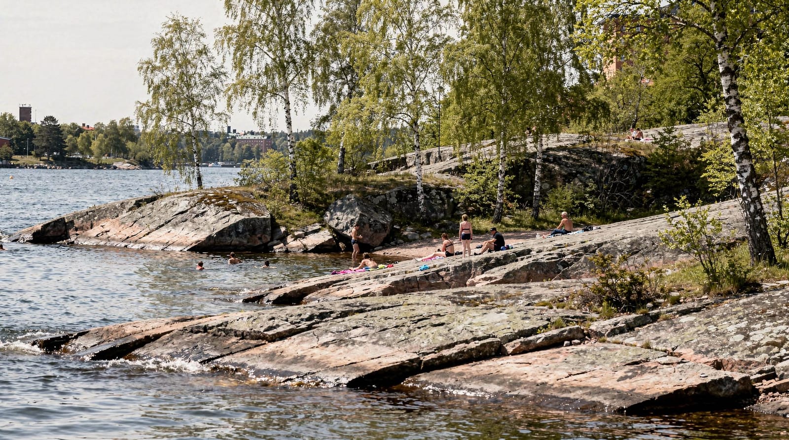
Combined with swimming: Långholmen’s southern shore (Långholmens strand) is one of Stockholm’s best urban swimming spots — the rocks are accessible and the water clean. See the Stockholm swimming spots guide. Långholmen is a short walk from Södermalm, so it combines easily with a wander through that neighbourhood before or after — see the Södermalm neighborhood deep dive for what to explore on foot.
Lake Trekanten loop (3.5km, flat)
Lake Trekanten is a small freshwater lake in Liljeholmen, southwest of Södermalm. Its perimeter path — 3.5 kilometres of flat, smooth tarmac — is primarily used by local runners and cyclists and is almost entirely car-free. It lacks the views of Djurgården or Långholmen but is consistently quiet, well-lit, and usable year-round including in winter.
Route: The lake perimeter is circular with no navigation required. The south side borders a park; the north side has a wider promenade used by both cyclists and runners. Entry is easiest from Liljeholmen station.
Surface: Smooth tarmac throughout. Excellent for road shoes.
Difficulty: Very easy. Flat, clear, well-signed at all junctions.
Why it’s worth knowing: When Djurgården is crowded with tourists or the weather is unsettled and you want a quick flat session, Trekanten delivers a reliable 3.5km loop with minimal planning required.
Nearest T-bana: Liljeholmen (red/green line), 5-minute walk south to the lake.
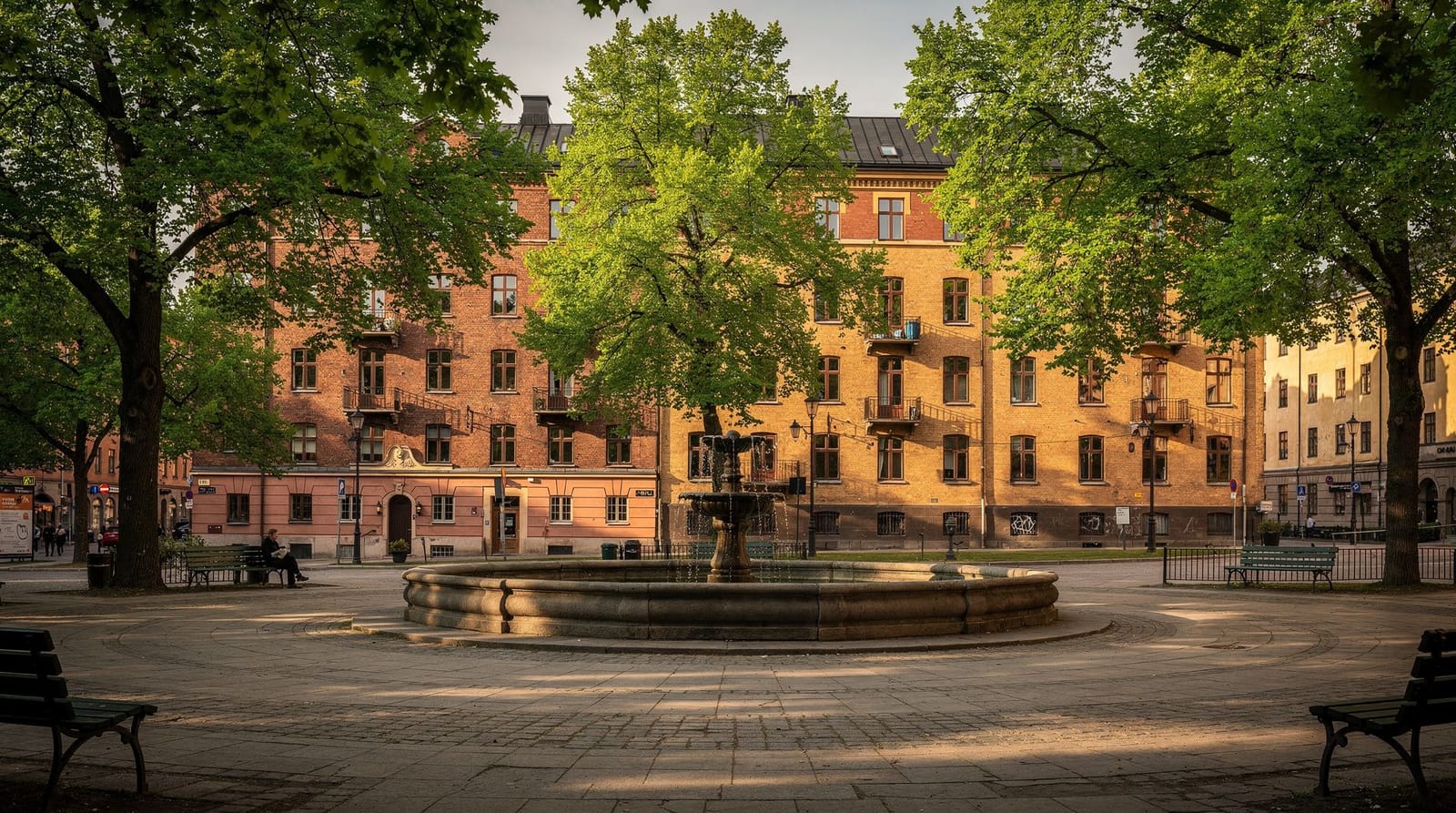
Stadshuset (City Hall) waterfront — 5km return
This is more of a point-to-point run than a loop, but the out-and-back format makes it naturally self-completing. Start from T-Centralen, run west along Norr Mälarstrand on Kungsholmen to the City Hall, continue around the Kungsholmen waterfront to the western tip of the island, then return the same way.
Route: T-Centralen → Stadshuset (via Hantverkargatan or waterfront) → Norr Mälarstrand heading west → Smedsuddsbadet waterfront → return.
Distance: Approximately 5km return, or up to 8km if you continue around the full Kungsholmen perimeter.
Surface: Predominantly smooth tarmac promenade on the south-facing Mälaren shoreline. Some sections on shared pedestrian/cyclist paths.
Highlights: The City Hall tower appears ahead of you on the outward run; the view of Riddarfjärden from Norr Mälarstrand in morning light is one of Stockholm’s classic scenes.
Difficulty: Easy. Flat waterfront, well-surfaced, minimal traffic.
Nearest T-bana: T-Centralen (direct start) or Stadshuset/Rådhuset (green line) closer to the route’s midpoint.
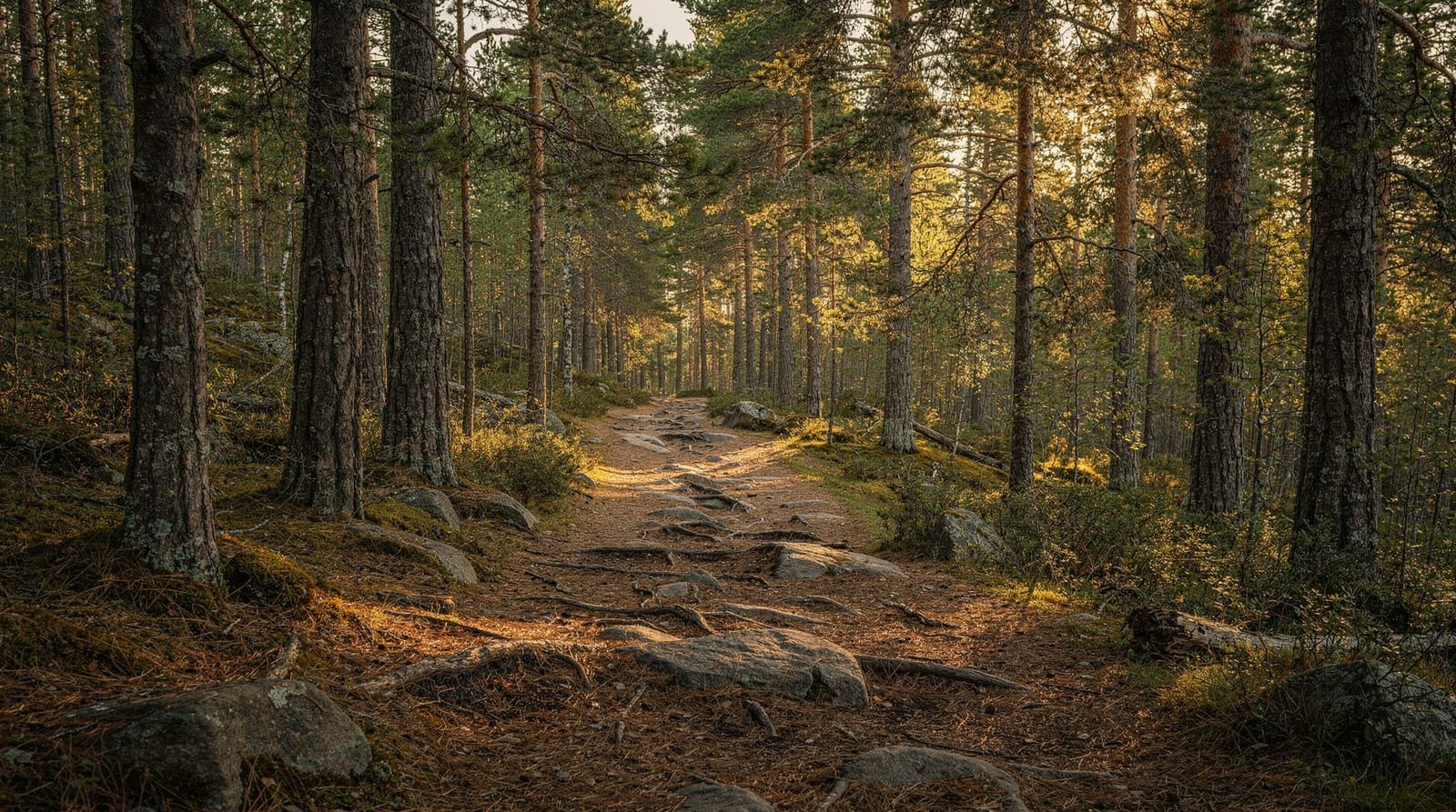
Ekoparken — extended nature run (5–15km, variable)
For runners who want distance rather than scenery loops, Stockholm’s Royal National City Park (Ekoparken) offers an interconnected network of trails running north from Djurgården through Hagaparken to Ulriksdal. The terrain varies from flat canal-bank paths to forested ridge runs.
Key sections:
- Djurgården north → Hagaparken via Brunnsviken lake: ~7km one way
- Hagaparken perimeter loop: ~5km
- Extended to Ulriksdal: ~15km from Djurgårdsbroen
Surface: Variable — tarmac, compacted gravel, forest path, and some rooted trail sections. Trail shoes recommended for the northern sections.
What makes it special: The sense of leaving the city. By the time you reach Brunnsviken lake, 25 minutes into a run from Djurgården, you could be in a forest 100km north of Stockholm. The park is continuous green space with no main road crossings once you are inside the northern perimeter.
Seasonal running in Stockholm
| Season | Conditions | Notes |
|---|---|---|
| May–June | Best: long days (18h+ daylight June), dry paths | Stockholm Marathon late May |
| July–August | Warm, paths busy with tourists on Djurgården | Go early morning |
| September | Excellent: autumn colours, cool temperatures | Best quality light for running |
| October–November | Wet, some path closures | Longer sessions better in parks |
| December–February | Dark, cold; ice possible on paths | Yaktrax/microspikes useful; waterfront paths gritted |
| March–April | Thawing paths, variable; improving light | Good transition season |
Running gear and logistics
Luggage storage: Several hotels near T-Centralen have luggage storage services. For same-day luggage deposit, see the luggage storage in Stockholm guide — useful if you want to run on arrival before checking in.
Water: Drinking fountains are present in Hagaparken and Djurgården but not always reliable outside summer. Running with a water bottle or hydration vest is recommended for runs over 45 minutes.
Apps: Strava has active Stockholm segments on all the routes above. The Naturkartan app covers the Ekoparken and Tyresta trail networks with offline maps useful for longer off-road runs.
Running clubs: Stockholm has an active running club scene. Notable regular group runs include the Djurgårdsrundan (Djurgården loop) on Tuesdays and Thursdays, meeting near Djurgårdsbroen at 7am — drop-in friendly and well-established.
Recovery: sauna and swimming after a run
Stockholm makes recovery easy. Several of the routes above finish near a place to cool down or warm up. After a Långholmen or Södermalm run, the lake and sea swimming spots in the swimming spots guide are minutes away. For a proper post-run warm-up in colder months, the Swedish sauna guide covers city saunas that welcome drop-ins, several within reach of the Djurgården and Kungsholmen routes.
Prefer two wheels to two feet?
If a run feels like too much commitment for the day, the same waterfront paths work just as well by bike, generally at a more relaxed pace and covering more ground. See the Stockholm bike tour guide or the broader cycling in Stockholm guide for rental options and routes that overlap closely with the running loops above.
Frequently asked questions about running in Stockholm
Is it safe to run alone in Stockholm at night?
Yes — Stockholm is one of Europe’s safest capitals, and running alone at night is commonplace, especially in summer when it never gets truly dark. The main waterfront routes (Norr Mälarstrand, Djurgården) are well-lit and used by other runners in the evenings. Standard urban awareness applies, but the risk level is low.
Where do I find running route maps for Stockholm?
Strava heatmaps show the most popular running routes at a glance. The City of Stockholm’s cycling and walking maps (available at the tourist office on Vasagatan and online) also cover running paths. Naturkartan covers the park and national park routes.
Can I run in Gamla Stan?
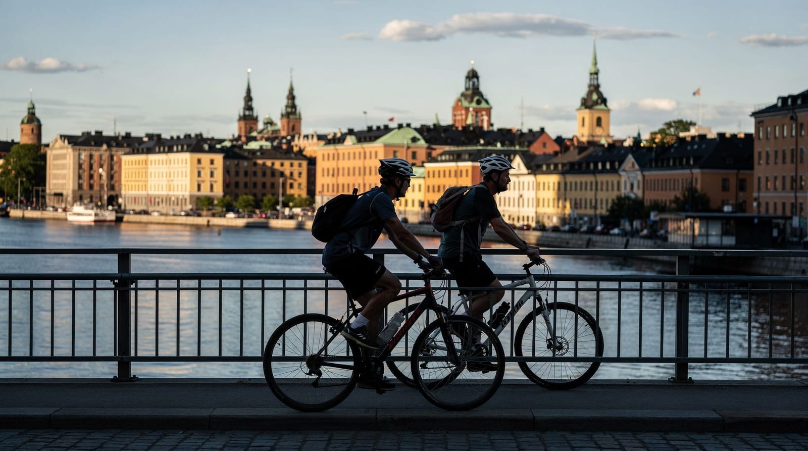
The cobblestones of Gamla Stan are not ideal for running — the surface is uneven, the lanes narrow, and pedestrian traffic is dense. However, running across Gamla Stan as a connecting route (crossing the bridges to reach Södermalm or Djurgården) is fine. The island’s outer edge on Skeppsbron is a smooth wide promenade popular with local runners at dawn.
What is the Stockholm Marathon route?
The Stockholm Marathon runs through the city centre, past the City Hall, along Strandvägen, through Gamla Stan, and finishes inside the Olympic Stadium (Stadion) on Östermalm — built for the 1912 Olympics. The race is held in late May or early June; registration opens six months in advance.
Are the Djurgården paths icy in winter?
Some sections of Djurgården’s gravel paths become icy in January and February. The main tarmac paths are typically gritted after snowfall. Many local runners use microspikes or Yaktrax in winter for the gravel sections. The canal bank path is the most reliably clear route in cold weather.