Hiking near Stockholm: Tyresta, Nacka, and the best day hikes
Stockholm: sunset hike in Tyresta National Park with meal
Duration: 4.5 hours
What is the best hiking near Stockholm?
Tyresta National Park — 40 minutes by bus from T-Centralen — is the easiest access to proper wilderness hiking near Stockholm, with ancient forest and lake swimming. Nacka Nature Reserve is closer (20 minutes) with well-marked trails. For longer routes, the Sörmlandsleden offers over 1,000km of marked trails starting from the city's southern edge.
Hiking from Stockholm: the honest situation
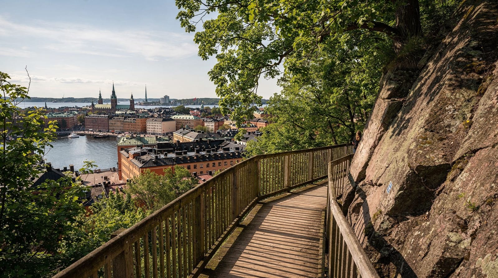
Stockholm sits on the edge of one of the most accessible wilderness areas of any European capital. Within 40 minutes of the city centre, you can be walking through ancient boreal forest where the nearest road is hours away on foot. The contrast with Paris or London is extreme.
| Closest option | Nacka Nature Reserve, ~20 minutes from T-Centralen |
| Best all-round | Tyresta National Park, ~40 minutes by bus |
| Cost | Free (Allemansrätten); guided hikes from around 600–900 SEK |
| Gear | Trekking shoes recommended; waterproof layer year-round |
| Best season | May–June or September for dry trails and fewer insects |
The key asset is Allemansrätten — Sweden’s “right of public access” to nature, including the right to walk, camp, and swim on nearly all land regardless of ownership. You do not need permission to walk through forests or across farmland; you are legally entitled to be there as long as you do not damage crops or disturb wildlife nesting areas. This transforms the hiking experience around Stockholm into something genuinely free-range.
The three main areas covered here — Tyresta, Nacka, and Sörmlandsleden — represent easy day trips with very different characters.
Tyresta National Park (40 minutes from Stockholm)
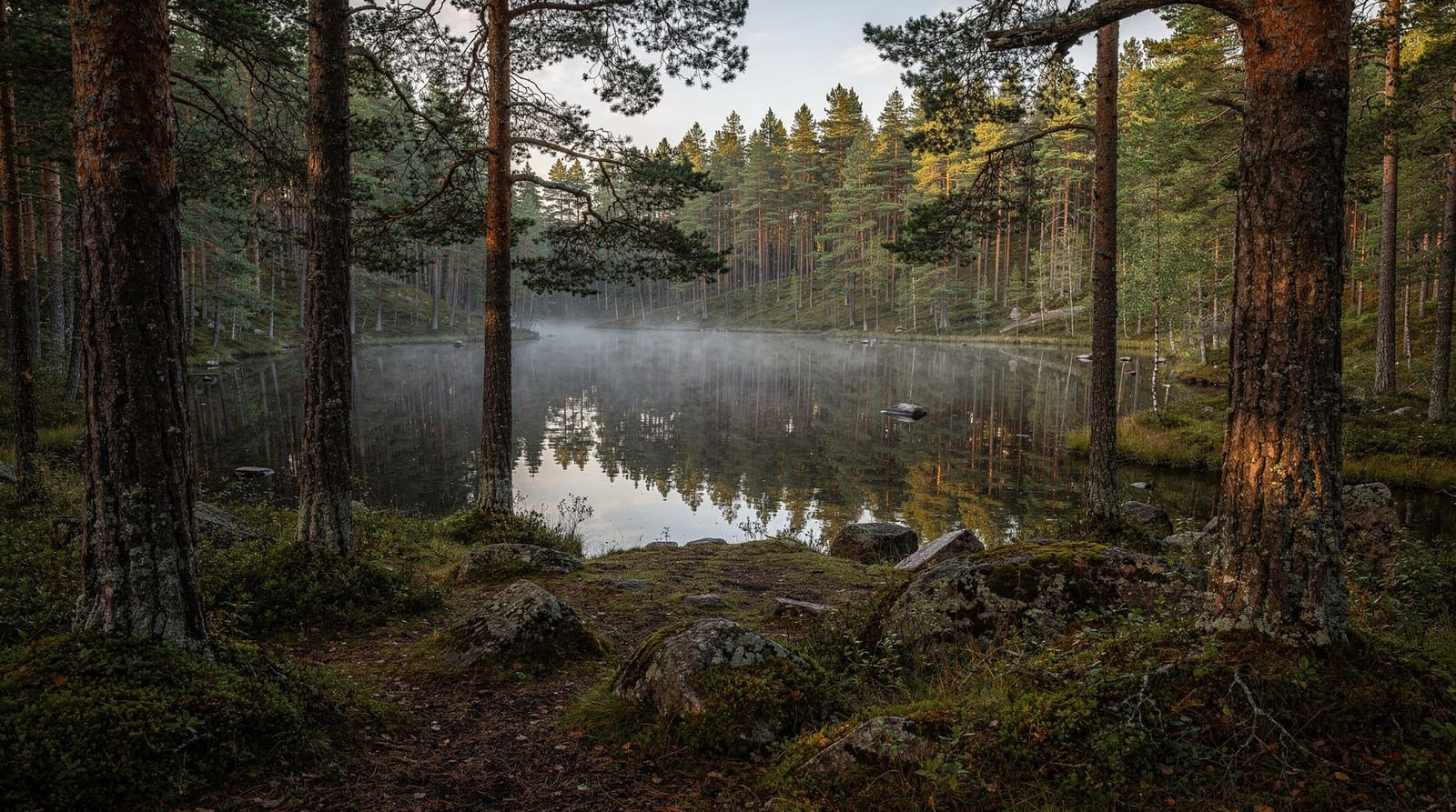
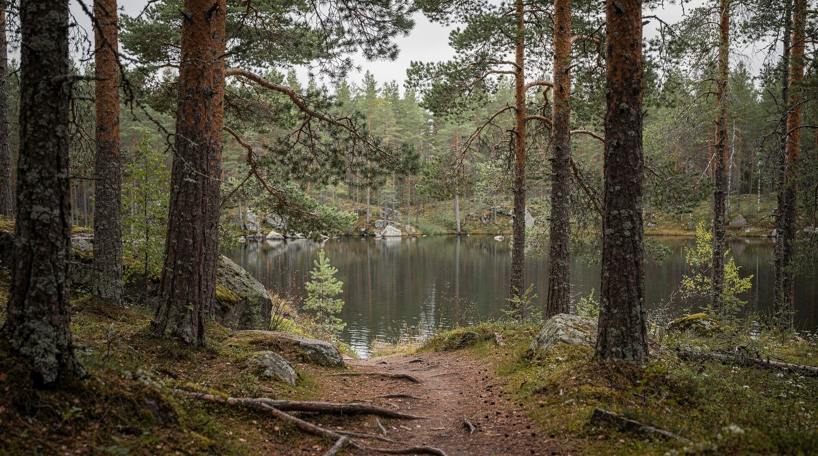
Tyresta is Sweden’s closest national park to a major city and one of the best day hikes accessible by public transport from any European capital. The park covers 5,000 hectares of largely unmanaged boreal forest — pine, spruce, and birch — with ancient trees up to 400 years old, Lake Tyresta for swimming, and enough trail network to keep a serious hiker busy for two days.
Book a sunset hike in Tyresta National Park with mealGetting there
By public transport: Take the T-bana to Gullmarsplan (green line), then bus 807 or 818 towards Tyresta village. Total journey approximately 40–50 minutes from T-Centralen. Buses run roughly every 30 minutes on weekdays, less frequently on weekends — check the SL app in advance.
By car: 25km south of Stockholm city centre via route 73. Parking at Tyresta village or Nature House (Naturhuset). Free.
Trail options
The park has a well-marked trail network ranging from 1km nature walks to full-day routes.
| Trail | Distance | Character |
|---|---|---|
| Åsen round trail | 4 km | Easy; good overview of forest and viewpoints |
| Tyresta Lake circuit | 8 km | Moderate; passes swimming beaches |
| Full park traverse | 15+ km | Challenging; requires good fitness and navigation |
The Tyresta Lake circuit is the recommended route for a day visit: it passes two good swimming spots (Tyresta sjön is a clean, dark freshwater lake ideal for a summer dip), reaches the highest viewpoint in the park, and returns through old-growth forest sections. Allow 3–4 hours.
Wildlife
Tyresta has a higher density of wildlife than the managed forests closer to Stockholm. Expect to encounter roe deer easily; moose are present but shy. Black woodpeckers, common cranes, and eagle owls have all been recorded here. The ancient forest sections have bat populations active at dusk.
Guided option
For those who want context with their hiking, guided sunset hikes with a meal are available via GYG — these cover the highlights in about 4.5 hours with a guide who can explain the ecology and history of the forest, followed by a traditional Swedish outdoor meal. The combination of late-summer evening light in the forest and food by a fire is genuinely memorable. For a full standalone guide to the park, including a more detailed route breakdown, see the Tyresta National Park day hike guide.
Book a Tyresta wildlife tour with dinner and short hikeNacka Nature Reserve (20 minutes from Stockholm)
Nacka lies immediately east of Stockholm, accessible by metro and bus in about 20 minutes from T-Centralen. It is a smaller reserve than Tyresta but offers surprisingly varied terrain for its proximity to the city — rocky ridges, pine forest, several lakes, and views east towards the inner archipelago.
Getting there
Take the T-bana to Slussen, then bus 401 or 409 eastbound. The main trailheads at Sickla are accessible in about 20 minutes. Nacka station (on the planned Citybanan extension) will improve access further in coming years.
What to expect
Nacka’s trails are well-marked with coloured blazes (orange for standard routes, red for more demanding ridge paths). The terrain is uneven — exposed granite bedrock is common underfoot, making trekking shoes more comfortable than trainers, though not essential in dry conditions.
The best day route from Sickla follows the Barnsjöleden trail circuit: about 10km, 3 hours, passing Baggensfjärden (an inlet of the inner archipelago) and the high ridge at Duvnäsberget with its views over the water. In summer, Flaten lake offers clean freshwater swimming.
Tourist tip: Nacka is a working nature reserve, not a tourist park. Facilities are minimal — a few signboards and wooden trail markers. Bring water and food from Stockholm; there are no cafés on the trails.
Hiking versus other ways to see nature near Stockholm
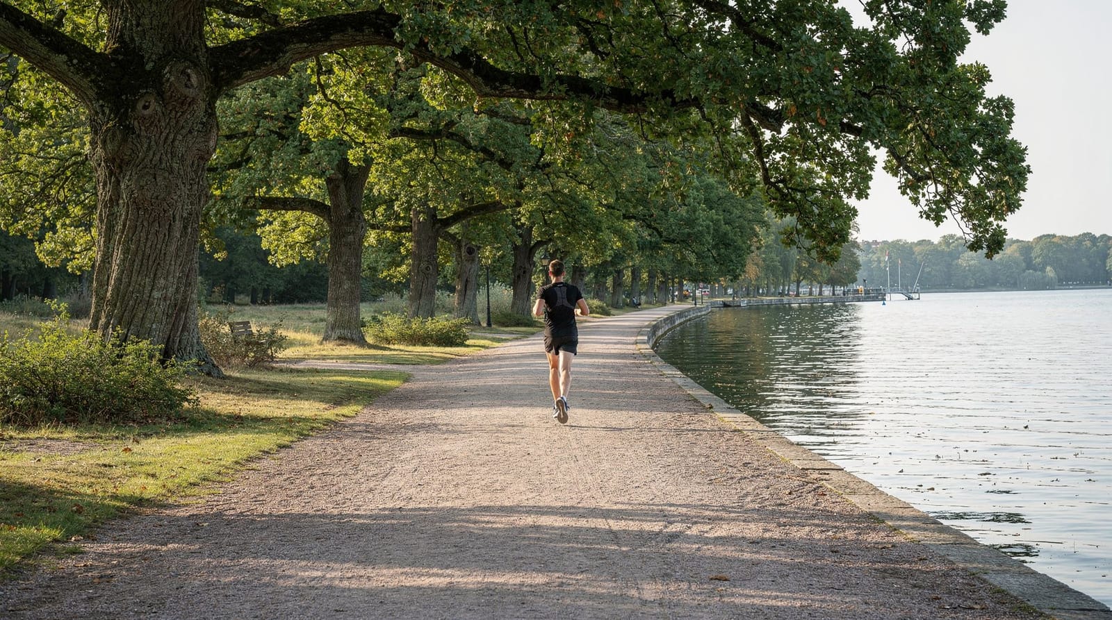
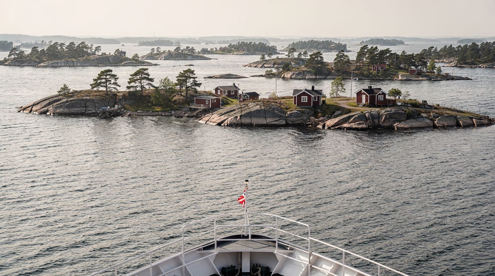
Hiking is not the only way to reach nature from the city, and it isn’t always the best fit for every visitor. If cycling suits your pace better, the Stockholm bike tour guide covers routes that reach some of the same green corridors faster and with less physical effort. If you’d rather run than walk, the urban running routes guide has options along the water and through Djurgården that double as light exercise without a bus journey. And if forest walking is really a proxy for wanting open water and islands, the Stockholm archipelago complete guide covers a genuinely different kind of nature day trip — boats and islands rather than trails and trees.
Sörmlandsleden (the grand trail)
The Sörmlandsleden is one of Sweden’s great walking trails — over 1,000 kilometres of marked paths through forests, farmland, lake shores, and Viking burial sites in the counties south and west of Stockholm. For hikers wanting more than a day’s walking, it is remarkable.
The trail technically begins in Stockholm itself (in Södermalm, which is why it sometimes appears in city hiking guides) and can be walked in sections of any length. Most visitors do 1–3 day stages.
Recommended sections for Stockholm visitors:
- Stage 1 (Södermalm → Huddinge): ~20km, follows the ridge south from Södermalm through wooded suburban terrain. Best for those who want to “walk out of Stockholm.”
- Stages around Lake Mälaren’s shores: Flat to gently rolling, with regular access to swimming and excellent views across the lake.
The trail is marked with the standard Swedish orange blazes. The Sörmlandsleden website has downloadable maps and updated trail condition reports (in Swedish, but Google Translate handles them well enough for route planning).
Skuleskogen National Park (6-hour drive — worth a weekend)
This entry sits outside “near Stockholm” territory but deserves mention for visitors considering a longer trip: Skuleskogen, on the High Coast in northern Sweden, is one of Scandinavia’s most dramatic coastal hiking areas. It requires either a long drive or an overnight train journey from Stockholm, and is best treated as a weekend or multi-day trip rather than a day outing.
If you have a week in Sweden and are serious about hiking, Skuleskogen combined with the High Coast (Höga Kusten, a UNESCO World Heritage Site for its dramatic post-glacial landscape) justifies the journey.
Practical hiking information for Stockholm
Gear
Trekking shoes are recommended for Tyresta and Nacka — trail surfaces are often uneven granite and root-covered forest floor. Running shoes are fine for the Djurgårdsleden (urban park walking). Waterproof layers are worth packing year-round; Swedish weather can turn in 30 minutes.
Water
Most natural water sources in Tyresta and Nacka are clean enough to drink with a filter or purification tablets, though this is not officially advised without testing. In practice, bringing 1.5–2 litres from Stockholm is sufficient for a day hike.
Allemansrätten in practice
You have the right to walk anywhere, camp up to two nights in any location that does not disturb private gardens or farmland, and swim in any lake or sea. The corresponding responsibilities are: leave no trace, do not light fires in dry conditions, do not disturb nesting birds or grazing animals, and do not pick plants designated as protected species. The Allemansrätten guide covers the full detail, including how it applies specifically to overnight stays in the archipelago rather than the mainland forests covered here.
Seasons
| Season | Conditions |
|---|---|
| May–June | Best: long days, dry trails, fewer insects |
| July–August | Good: warm but mosquitoes in Tyresta forest; popular |
| September | Excellent: autumn colour, fewer people, clear skies |
| October–November | Doable with proper clothing; trails can be wet |
| December–March | Cold, possible snow; dramatically beautiful if properly equipped |
Frequently asked questions about hiking near Stockholm
Can I hike in Tyresta without a guide?
Absolutely. The park is well-marked and the trail network is signed in Swedish and English at key intersections. Download the Naturkartan app (free, works offline) for trail maps. A guided tour adds ecological and historical context but is not necessary for navigation.
Are there bears or wolves near Stockholm?
No. The large predators of Swedish forests — wolves, bears, lynx — live in forested areas well north of Stockholm. The wildlife in Tyresta and Nacka is deer, foxes, birds, and in summer, significant numbers of mosquitoes in low-lying wet areas.
Is Nacka accessible by public transport?
Yes. Multiple bus routes from Slussen and Gullmarsplan serve the Nacka reserve, with journey times of 20–30 minutes. Check the SL app for current routes and timetables.
What is the difference between Tyresta and Nacka for a first-time visitor?
Tyresta is larger, wilder, and more remote-feeling — it is a proper national park with ancient forest. Nacka is closer, more urban-adjacent, and has good lake views but a less dramatic forest feel. For a day trip on limited time, Nacka is more practical. For the full experience of being away from the city, Tyresta is worth the slightly longer journey.
Can I combine hiking with swimming in summer?
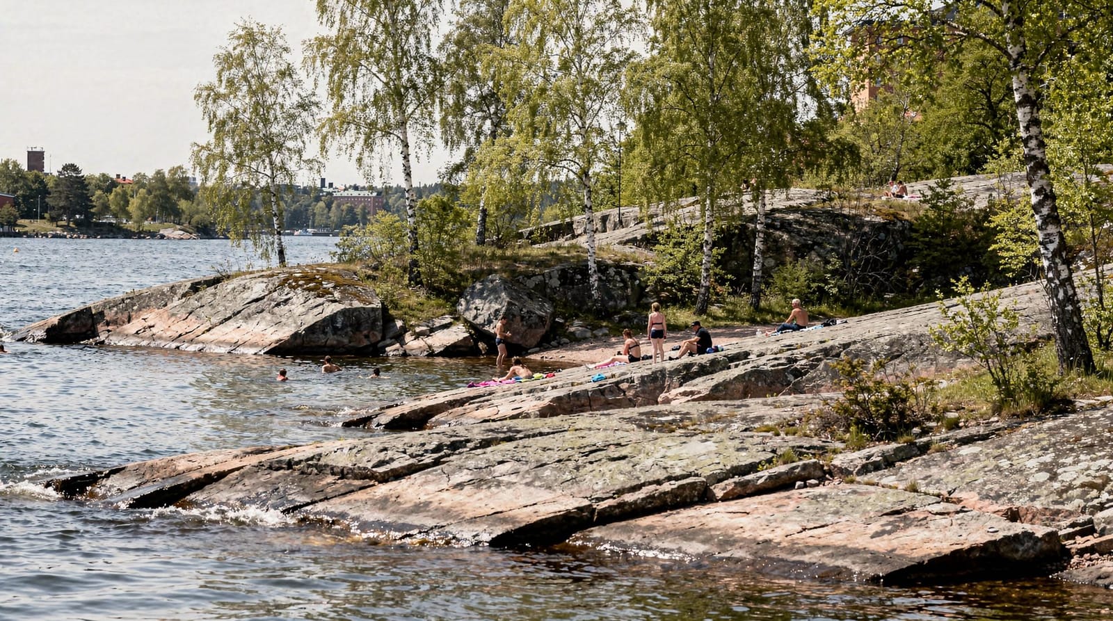
Yes — both Tyresta and Nacka have clean lake swimming. In Tyresta, Lake Tyresta (Tyresta sjön) has a small beach. In Nacka, Lake Flaten is the main bathing spot. See the Stockholm swimming spots guide for more detail on urban and suburban swimming in the city itself.
Do I need to book anything in advance for Tyresta or Nacka?
No, not for a self-guided walk — both are open access under Allemansrätten with no entry fee or booking requirement. The only reason to book ahead is for a guided tour (sunset hike, wildlife dinner), where slots can fill on summer evenings, or if you want a specific bus time confirmed via the SL app during a busy weekend.
Is hiking near Stockholm suitable for beginners or families?
Yes, particularly Nacka and the shorter Tyresta circuits like the 4km Åsen round trail. The terrain is manageable for most fitness levels and the trails are clearly marked, so getting lost is unlikely if you stay on the signed routes. Families should budget extra time for children’s pace and bring snacks, since neither reserve has cafés on the trails themselves.
Top experiences
Bookable activities with verified prices and instant confirmation on GetYourGuide.