Stockholm public transport explained: T-bana, buses, trams and ferries
How do you get around Stockholm using public transport?
Stockholm's SL network is straightforward: use the T-bana (metro) as your backbone for cross-city trips, city buses for areas the metro misses, and tram 7 for Djurgården. Pay with the SL app, an SL Reskort card, or tap contactless at gates. A 24h pass costs 175 SEK and covers unlimited trips.
Why Stockholm’s network works so well for visitors
Stockholm’s public transport network (operated by SL, or Storstockholms Lokaltrafik) connects the city’s fourteen islands and mainland suburbs in a tightly integrated system. For visitors, it is genuinely easy to use: the T-bana reaches most tourist areas, single tickets allow unlimited transfers within 75 minutes, and contactless payment works everywhere. You rarely need to plan complex connections.
That said, understanding the different components — T-bana, buses, trams, commuter trains, and ferries — helps you avoid the common mistake of relying only on the metro and missing faster or more scenic routes.
| Network | T-bana (7 lines), buses, trams, Pendeltåg, Waxholmsbolaget ferries |
| Cost | Around 42 SEK/single tap; 175 SEK/24h pass |
| Payment | Contactless card, SL app QR code, or SL Reskort — no cash |
| Hub | T-Centralen, connecting nearly every line |
| Best time | Off-peak (avoid 07:00–09:00 and 16:00–18:00 on red/green lines) |
For how the SL network compares to buying a Stockholm Pass, or whether you need both, see Stockholm Pass vs Go City vs SL and the dedicated SL pass guide for the full ticket and zone breakdown.
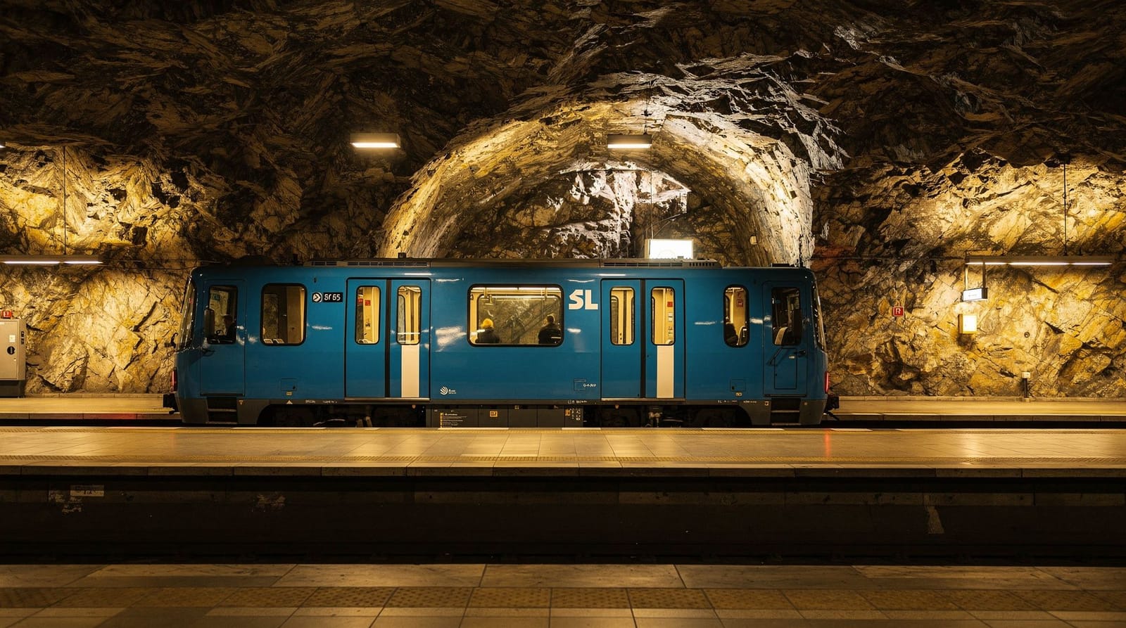
T-bana: the metro backbone
The T-bana (Tunnelbana, meaning “tunnel road”) operates seven lines across three colour-coded trunk routes. The system is notable for its station art: from the 1950s onward, each new station was designed by different artists, making the T-bana one of the world’s longest art galleries. Solna Centrum, Kungsträdgården, and T-Centralen are particularly spectacular.
Red line (T13 and T14): Runs roughly north-south through the city, serving Östermalmstorg (near Östermalm and the food market), T-Centralen, Gamla Stan, Slussen, and south toward Skärholmen and Fruängen.
Blue line (T10 and T11): The newest line, opened in phases. Connects T-Centralen east to Universitetet and Mörby Centrum (T10/T11) and west/northwest via Fridhemsplan, Hjulsta, and Akalla. Key tourist stop: Stadshuset (City Hall) is walkable from Rådhuset on the blue line.
Green line (T17, T18, T19): The original 1950 metro. Serves Odenplan (for Vasastan and the Vasa Museum’s neighbourhood), Hötorget (for Sergels Torg and Kulturhuset), Tekniska Högskolan (near the Karolinska area), and extends south to Farsta, Hagsätra, and Skarpnäck.
T-bana frequency and hours
Peak hours (07:00–09:00 and 16:00–18:00): every 3–5 minutes on major lines. Off-peak daytime: every 8–12 minutes. Evenings: every 10–15 minutes. Late night (after midnight): reduced; check SL app. Night buses continue when trains stop.
Getting to tourist areas by T-bana
| Destination | Nearest T-bana station | Notes |
|---|---|---|
| Gamla Stan | Gamla Stan (red line) | Exit directly into the Old Town |
| Södermalm | Slussen or Medborgarplatsen | Slussen for Fjällgatan and views |
| Djurgården | No direct stop | Take bus 69 or tram 7 from Slussen/Sergels Torg |
| Skansen / ABBA Museum | Tekniska Högskolan + bus | Or tram 7 in summer |
| Vasa Museum | Bus 69 from T-Centralen area | Or walk 25 min via Strandvägen |
| City Hall (Stadshuset) | Rådhuset (blue line) | 10-minute walk along the waterfront |
| Östermalm food hall | Östermalmstorg (red line) | Direct exit |
City buses
Stockholm’s bus network fills the gaps the metro cannot reach, particularly in Djurgården, along the waterfront, and in newer neighbourhoods. Key routes for visitors:
Bus 69: T-Centralen → Karlaplan → Djurgårdsbrunn → Vasa Museum → Skansen → Djurgården. The main bus route for Djurgården museums; runs year-round.
Bus 7 (SL Spårväg City): Actually a tram (see below), but worth knowing for the Strandvägen → Djurgården connection.
Bus 65: Links central Stockholm with Nacka and the SkyView/Ericsson Globe area (combined with walk or bus).
Buses in Södermalm: Numerous routes cross Södermalm; buses 2, 3, 55, and 66 are frequently useful.
Stockholm buses do not sell tickets onboard. Tap contactless, show an SL app QR code, or tap an SL Reskort before boarding at the front door. Drivers will direct you to do so — they cannot accept payment.
Trams
Tram 7 (Spårväg City): Runs from T-Centralen (via Nybroplan and Strandvägen) through Djurgården to Waldemarsudde. In summer this is the most pleasant way to reach Djurgården — the route along Strandvägen passes some of Stockholm’s finest waterfront architecture. Operates year-round but with reduced frequency in winter.
Tram 12 (Lidingöbanan): Connects Ropsten T-bana station (blue line) with the island of Lidingö. Useful for Millesgården sculpture museum (a hidden gem worth the 30-minute journey).
Tram 22 (Djurgårdslinjen): A heritage tram running in summer along Djurgårdslinjen from Norrmalmstorg to Skansen. More scenic than functional, but a pleasant way to travel the island in period trams.
Commuter trains (Pendeltåg)
Five commuter rail lines (J35–J45) connect Stockholm’s central area with suburban communities up to 60 km away. For tourists, the most relevant are:
J41 (Arlanda direction): Runs from T-Centralen northward through Solna, Sundbyberg, and up to Arlanda Central and eventually Märsta. This is the commuter option for reaching Arlanda Airport — see the additional Arlanda station supplement note in our Arlanda airport guide, and the Arlanda Express vs commuter train comparison for whether the faster, pricier express is worth it over the Pendeltåg.
Book an Arlanda airport train transferJ35/36 (Södertälje direction): Heads south through Flemingsberg toward Södertälje. Useful for reaching Tom Tit’s Experiment science museum in Södertälje (a family favourite, about 30 min from T-Centralen).
Archipelago ferries (Waxholmsbolaget)
Waxholmsbolaget operates the public ferry network across Stockholm’s inner archipelago, departing primarily from Strömkajen (the quay running along the edge of Blasieholmen, between the Grand Hôtel and Nationalmuseum). SL passes are valid on Waxholmsbolaget routes within the SL zone — see our ferries guide for a full explanation.
Key departures from Strömkajen:
- Fjäderholmarna (innermost archipelago island, 25 min)
- Vaxholm (75–90 min)
- Grinda (about 2 hours)
- Sandhamn (outer archipelago, not in SL zone, requires a separate ticket)
Ferries generally depart 2–4 times per day outside summer; in July and August departures are much more frequent. Plan around the schedule, as missing a ferry can mean a 2–3 hour wait.
How to pay
Contactless card / Apple Pay / Google Pay: Tap directly at T-bana gates (the tall oval readers), on buses (tap the reader as you board, near the driver), and on trams (tap at the reader onboard). Each tap charges a single-journey fare (42 SEK in 2026).
SL app: Download the app before arriving. Buy 24h, 72h, or 7-day passes, display a QR code when prompted. The app also shows live departures, alerts, and Waxholmsbolaget ferry schedules.
SL Reskort: A reloadable plastic card available from T-bana ticket machines or SL Kundservice offices at T-Centralen and other major stations. Load credit or timed passes. If you visit Stockholm multiple times per year, the Reskort is convenient.
Cash: Not accepted anywhere on SL. Not at drivers, not at machines. Plan ahead.
Navigating the system
SL Journey Planner (sl.se or SL app): Enter your start and end points; it calculates the fastest route including transfers, real-time delays, and the walk to/from stops.
Google Maps and Apple Maps: Both integrate SL data and are reliable for real-time navigation. Useful for tourists already familiar with one app.
Which direction on the T-bana? At each station, signs indicate the end destination of each line branch. Stockholm T-bana maps are displayed in every station and on the SL app. The three trunk routes are colour-coded consistently throughout the system.
Accessibility
Stockholm’s SL network has elevated in accessibility over the past decade. All T-bana stations have lifts, and modern T-bana cars have low-floor boarding. Buses are fully low-floor accessible. Waxholmsbolaget ferries vary; larger vessels have ramps and accessible toilets. The SL website has a specific accessibility section for each station and service. See our full accessibility guide for a broader look at mobility in Stockholm.
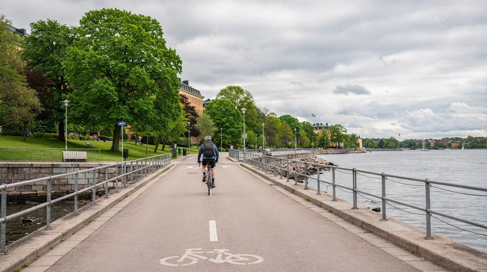
Cycling as an alternative
Stockholm’s flat, compact centre and dedicated cycle lanes make cycling a genuine alternative to SL for parts of your visit, particularly between neighbourhoods that require an awkward transit transfer by T-bana. Combining a day of cycling with public transport for longer hops (or when the weather turns) works well rather than choosing one exclusively. See the cycling in Stockholm guide for bike rental options and the best routes.
Night travel
After the T-bana closes (approximately 01:00 weekdays, later on weekends), SL night buses replace most metro routes. The coverage is good but less frequent — departures every 15–30 minutes on main routes. Check the SL app for live schedules. Night buses use the same SL passes and contactless payment.
Practical tips
Peak hour crowds: T-bana rush hours (07:30–09:00 and 16:00–18:30) can be busy, particularly on red and green lines through T-Centralen. With luggage, the blue line or a bus is often more comfortable.
Validate before boarding: On buses and trams, you tap before boarding (there is no gate at the vehicle). On the T-bana, there are gates. Fare inspection teams operate on all SL services, and fines for fare evasion are substantial.
Real-time disruptions: SL runs planned maintenance closures, often on weekends. Check the app’s alert section before any journey relying on a specific line, particularly on blue-line weekend mornings.
Languages: All SL station announcements, signs, and the app are available in English. Ticket machines at T-bana stations have English interfaces.
Frequently asked questions about Stockholm public transport explained
How do you pay on Stockholm public transport?
Three ways: tap contactless Visa/Mastercard (or Apple/Google Pay) directly at the gate or reader; show a QR code from the SL app; or tap an SL Reskort card. Cash is not accepted on any SL service. Tickets cannot be bought from drivers on buses.How many T-bana lines are there in Stockholm?
Seven lines (T10, T11, T13, T14, T17, T18, T19) organized into three trunk routes: red (T13/14), blue (T10/11), and green (T17/18/19). All lines converge at T-Centralen in the city centre.How late does Stockholm public transport run?
T-bana runs until approximately 01:00 on weekdays, 02:00–03:00 on Friday/Saturday nights. Night buses cover gaps overnight. The SL app shows live departures and night-bus routes.Is Stockholm public transport good for tourists?
Yes, Stockholm's SL network is well-maintained, frequent, and covers essentially all tourist areas. Djurgården (museums island) is served by tram 7 and bus 69. Gamla Stan has its own T-bana station. The network is clean, safe, and generally runs on time.What are the main transport hubs in Stockholm?
T-Centralen (Central Station) is the main hub where all T-bana lines, commuter trains, Arlanda Express, and long-distance buses converge. Slussen is the key transfer point for Södermalm and ferries south. Strömkajen is the main departure point for archipelago ferries.Should I buy an SL pass or just tap contactless for each trip?
It depends on how many trips you'll make. A single contactless tap costs 42 SEK per 75-minute window; a 24h pass costs 175 SEK, breaking even at around 5 journeys in a day. Visitors doing heavy sightseeing across multiple neighbourhoods, or combining T-bana with an archipelago ferry, usually come out ahead with a timed pass. Those mostly walking between central sights and using transit once or twice a day may be better off tapping individually. See the full SL pass guide for the detailed break-even math.Is Uber or Bolt a reasonable alternative to SL in Stockholm?
As an occasional supplement, yes — particularly late at night after the T-bana closes, or with heavy luggage. As a primary way to get around, no: taxi fares in Stockholm run well above SL fares for the same journey, and the SL network reaches nearly every tourist area efficiently. Most visitors are better served using SL as the default and reserving rideshare for the gaps — late-night trips, direct airport transfers, or accessibility needs SL can't accommodate.